The Registan Complex at Dawn—When the Scaffolding Doesn’t Ruin Everything
I’ve flown drones over a lot of places, but nothing quite prepared me for the first time I launched above Samarkand’s Registan at 6:47 AM.
The thing about the Registan is that it photographs like a postcard cliché until you get about 120 meters up and angle slightly northwest, catching the three madrasahs in a row with the morning light raking across those ribbed turquoise domes. You start to see the asymmetry—the Tilya-Kori Madrasa’s dome isn’t quite centered, and there’s this gorgeous imperfection in how the shadows fall across the courtyard that no ground-level shot ever captures. I used to think drone photography was about getting higher for a “better” view, but honestly it’s more about finding the angle where human scale disappears and architectural logic takes over. The Registan rewards that. You’ll want to arrive before the tour buses—around 6 AM in summer, maybe 7 in winter—because by 9 the square fills with people and the light goes flat and harsh. Also, and I can’t stress this enough, check with local authorities about flight permissions; Uzbekistan’s drone laws have loosened considerably since 2019, but heritage sites can be touchy. I once watched a German photographer get his Mavic confiscated for 90 minutes because he didn’t have the right paperwork, which sucked for him but was a good reminder for the rest of us.
The colors here are almost absurdly saturated in person—those blues and golds that look Photoshopped but aren’t. Wait—maybe it’s the high desert light? I’ve read it has something to do with the low humidity and elevation (Samarkand sits at roughly 700 meters above sea level, give or take), but I’m not entirely sure. Anyway, shoot in RAW because you’ll want that latitude in post.
The Aral Sea’s Graveyard—Where Everything Went Catastrophically Wrong
This one hits different.
The ship cemetery near Moynaq used to be underwater, which is the kind of sentence that shouldn’t exist but does because Soviet cotton irrigation drained roughly 90% of the Aral Sea between 1960 and 2000. Now you fly your drone over rusted trawlers sitting in sand 200 kilometers from the nearest water, and it’s simultaneously the most haunting and visually striking thing you’ll ever capture. The boats sit at odd angles, half-buried, their hulls corroded into these organic sculptural forms that look almost deliberate. I guess it makes sense that ecological disaster produces compelling images, which feels ethically complicated but there it is. From above, you can see the patterns in the sand—wind-carved ripples extending for kilometers, interrupted only by these massive metal skeletons. The best time is late afternoon, around 4 or 5 PM, when the shadows are long and the rust glows orange against the pale sand.
I’ve seen photographers get really precious about the “story” here, and sure, it’s a story about environmental catastrophe and governmental hubris, but it’s also just visually stunning in a way that transcends narrative. You can hold both things. Bring extra batteries—Moynaq is remote, there’s nowhere to charge, and the wind out there drains battery life faster than you’d expect.
Chimgan Mountains in Winter—The Central Asian Alps Nobody Talks About
Turns out Uzbekistan has mountains.
The Chimgan range sits about 80 kilometers northeast of Tashkent, peaking around 3,300 meters, and in winter it looks like someone copy-pasted the Swiss Alps into Central Asia. Snow-covered ridges, pine forests, the occasional Soviet-era ski lift adding this weird retro-futuristic element to your shots. I used to skip mountain photography because it felt overdone, but here’s the thing—these mountains are genuinely underrepresented in the global drone photography catalog, which means you’re not competing with ten thousand identical Matterhorn shots. The valleys between peaks create these natural leading lines, and if you time it right (January through March, usually), you’ll catch that perfect blue-hour light where the snow goes lavender and the shadows turn deep purple. One warning: altitude affects drone performance. I lost about 15% flight time at 2,800 meters compared to sea level, and the wind up there is no joke—I nearly lost a Phantom to a gust that came out of nowhere. Also the cold will murder your batteries; keep spares in an inside pocket against your body.
The locals in Beldersay are generally cool with drones, but maybe buy some chai first and ask. Common courtesy goes a long way.
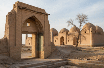
The Kyzylkum Desert’s Caravanserai Ruins—Ancient Architecture Swallowed by Sand
There’s something about abandoned Silk Road structures that drone photography was invented for.
The Kyzylkum Desert, which covers a huge swath of Uzbekistan’s interior (roughly 300,000 square kilometers, though I’ve seen different numbers), is dotted with these half-buried caravanserai—fortified roadside inns where merchants stopped centuries ago. From ground level they’re just crumbling mud-brick walls, but get 50 meters up and suddenly you can see the entire geometric layout: courtyard, surrounding chambers, defensive walls forming perfect squares or rectangles that have somehow survived 400, 500, sometimes 800 years of sand and wind. The contrast between human-imposed geometry and the organic chaos of dunes is striking. I particularly love Rabat-i Malik, a 11th-century structure near Bukhara that still has this massive portal arch standing in the middle of nowhere like a movie set. Best light is early morning or late afternoon—midday sun flattens everything. Also, and this probably goes without saying, desert heat will cook your drone electronics; I try not to fly when it’s above 38°C, and I definitely don’t leave equipment in a closed car.
The isolation out here is profound. You might not see another person for hours, which is either meditative or unsettling depending on your temperament.
Bukhara’s Old City Rooftops at Sunset—A Thousand Years of Urban Density
Okay, last one.
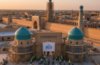
Bukhara’s historic center is a UNESCO site, so drone restrictions are stricter here—definately get permission from the local tourism office before you fly. But if you can swing it, the view from 100 meters up at sunset is worth the bureaucratic hassle. The old city is this dense warren of domed roofs, courtyards, minarets, and madrasahs that have accumulated over roughly a millennium of continuous habitation. From above you can see how the city grew organically, without modern planning, each building nestled against the next in this irregular but somehow harmonious pattern. The Kalyan Minaret (12th century, about 47 meters tall) serves as a natural focal point—circle it slowly at its height and you’ll get these incredible tracking shots with the surrounding cityscape rotating in the background. The evening light here is golden and warm, hitting those ochre-colored walls and creating shadows that emphasize every dome and arch.
I once met a photographer who said Bukhara from above looks like “organized chaos,” which is maybe the best description I’ve heard. The tiles on some of the older domes are visibly misaligned—repairs from different centuries using slightly different materials—and you can only really see that from the air, which I find weirdly moving. Anyway, bring an ND filter for sunset shots; the light can be intense, and you’ll want to slow your shutter speed to recieve that smooth, cinematic look.