The Chimgan Mountains: Where Soviet Infrastructure Meets Genuine Wilderness
I used to think all mountain trails needed to be remote to feel authentic.
Then I spent three days in the Chimgan range, about 80 kilometers northeast of Tashkent, and realized that sometimes the juxtaposition of crumbling ski lifts and wildflower meadows creates something more interesting than pristine isolation. The trails here wind through landscapes that feel—I don’t know how else to put it—emotionally complicated. You’ll hike past abandoned Soviet-era resort buildings, their concrete facades slowly being reclaimed by juniper scrub, then round a corner to find valleys so untouched they could’ve looked the same roughly 5,000 years ago, give or take. The main trail to Big Chimgan peak (3,309 meters) takes about six hours if you’re reasonably fit, though I’ve seen groups take nine because they kept stopping to photograph the view across the Chatkal range. Here’s the thing: the trail isn’t technically difficult, but the altitude hits harder than you expect, and by the time you’re at 2,800 meters, even experienced hikers are breathing like they’ve just sprinted up five flights of stairs.
Aksu-Zhabagly Nature Reserve: The Trail That Taught Me About Patience
Honestly, I almost skipped this one.
The reserve sits in the western Tian Shan, straddling the border with Kazakhstan, and getting there requires either a very early morning marshrutka ride or a somewhat dubious hired driver situation. But the Aksu Canyon trail—especially the route up to the Kshi-Kaindy waterfall—turned out to be one of those hikes that recalibrates your understanding of what Central Asian biodiversity actually looks like. The lower elevations are all wild apple and walnut forests (Malus sieversii, if you’re keeping track, the genetic ancestor of most cultivated apples), and as you climb, the vegetation shifts through distinct zones like you’re walking through a vertical museum of ecological succession. I counted at least forty species of wildflowers in mid-May, though I’m definitely not a botanist and probably misidentified half of them. The trail gains about 900 meters over twelve kilometers, which sounds manageable until you factor in the river crossings—there are four or five depending on the season, and in spring runoff, they’re genuinely challenging. Wait—maybe challenging isn’t the right word. Nerve-wracking? You’re stepping across slick boulders with glacial meltwater rushing past your shins, and if you slip, you’re going for a very cold, very fast swim.
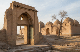
The Nuratau Mountains: Where Hiking Becomes Cultural Immersion Whether You Want It Or Not
This range runs east-west through central Uzbekistan, and the trails here are less about conquering peaks and more about moving through landscapes that humans have actively shaped for millennia.
You’ll hike past petroglyphs that might be 3,000 years old (the dating is, frankly, all over the place depending on which archaeologist you ask), through walnut groves that villagers still harvest every autumn, past shepherds who’ll probably invite you for tea if you make eye contact for more than three seconds. The route from Sentob to Hayat involves about 600 meters of elevation gain through terrain that shifts from desert scrubland to montane forest in a way that feels almost theatrically abrupt. I guess it makes sense—the Nuratau range captures moisture coming off the Kyzylkum desert, creating these weird ecological islands of greenery. But it still looks wrong somehow, like someone Photoshopped a forest onto a desert backdrop. The trails aren’t well-marked, and you’ll definately want either a guide or very good offline maps, because I’ve watched multiple groups spend an extra two hours wandering in circles trying to find the path to Lake Fazilman.
Zaamin National Park: The Juniper Forests That Smell Better Than Anything Has a Right To
Zaamin sits in the western Turkestan range, and the signature hike here is the trail through what locals call the “relict juniper forests”—basically, ancient Juniperus seravschanica stands that have been growing in these exact spots for, depending on who you ask, anywhere from 1,000 to 5,000 years.
The smell hits you before you even see the trees. It’s sharp, resinous, somehow both medicinal and comforting, and it clings to your clothes for days afterward. The main trail loops through about fifteen kilometers of mixed forest—juniper, maple, wild rose—with elevation changes that are noticeable but never punishing. You gain maybe 400 meters total, which makes this ideal if you’re still acclimatizing or if you’re just tired of trails that turn into vertical slogs. I’ve seen families with young kids manage it comfortably, though the trail surface is rocky enough that you’ll want actual hiking boots rather than sneakers. The park also has a few Soviet-era rest houses that now operate as guesthouses, and staying overnight means you can start hiking at dawn when the light through the juniper canopy does this thing—I’m not being poetic here, it literally refracts through the needle clusters in a way that makes the whole forest look like it’s underwater.
The Beldersay-Kumbel Route: Where I Learned That “Moderate” Is a Meaningless Word
Turns out, when Uzbek hiking guides say “moderate difficulty,” they mean something very different than what that phrase means in, say, Colorado or Switzerland.
The Beldersay valley sits adjacent to Chimgan, and the trail up to Lake Kumbel is listed everywhere as a moderate day hike suitable for intermediate hikers. It’s about eighteen kilometers round trip with roughly 1,100 meters of elevation gain, which on paper sounds fine. In practice, the trail is relentlessly steep in sections, poorly maintained in others, and crosses several scree fields where the “path” is more of a collective agreement about which pile of loose rocks to scramble over. I made it to the lake—a small alpine tarn at about 2,900 meters, surrounded by peaks that still had snow in July—but I was genuinely exhausted in a way I haven’t been on trails that were supposedly much harder. Here’s what nobody tells you: the last three kilometers are basically a psychological endurance test. You can see the lake from far away, shimmering in its glacial basin, but the switchbacks just keep coming, and every time you think you’re close, the trail bends away and climbs another hundred meters. When you finally arrive, the water is so clear you can see individual rocks at five meters depth, and there’s usually nobody else there because most people turn back at the halfway point. I sat there for probably forty minutes, too tired to even eat the sandwich I’d carried up, just watching the light change on the surrounding peaks and wondering why I do this to myself.