The van lurched to a stop somewhere between Samarkand and what my guide kept calling “the real Uzbekistan,” and I realized I’d forgotten to bring enough water.
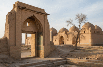
Here’s the thing about the Nurata Mountains: they don’t announce themselves the way dramatic peaks usually do, with snow-capped summits or jagged ridges tearing through clouds. Instead, they rise gradually from the Kyzylkum Desert like an afterthought, their slopes covered in sparse vegetation that looks perpetually tired. The range stretches roughly 170 kilometers east to west, reaching elevations around 2,169 meters at their highest point, though honestly the numbers felt less important than the sheer improbability of finding springs—actual flowing water—in what should be bone-dry terrain. Geologists attribute this to ancient fault lines that channel groundwater upward, creating what locals have considered sacred for centuries, maybe millennia. I used to think “sacred spring” was mostly tourism marketing, but watching pilgrims wash their hands in the Chashma complex pools with genuine reverence made me reconsider. The water stays cool even in summer, around 19-20 degrees Celsius, and the stones around the main spring basin are worn smooth from centuries of touch.
Turns out the springs aren’t just culturally significant—they support an entire ecosystem that shouldn’t exist here. There are these markhurs, wild goats with spiral horns that can grow up to 160 centimeters, wandering slopes where vegetation barely clings on. The Nurata Nature Reserve, established in 1975 or thereabouts, protects about 22,000 hectares of habitat that feels like it’s defying basic ecological logic.
Ancient Hands Drew What They Could Not Name on Stone Walls Still Standing
The petroglyphs aren’t easy to find, which I guess makes sense—nobody carved them next to parking lots. Our guide led us up a rocky path where the stones had split and tumbled in ways that suggested serious geological time, and there they were: figures etched into dark rock faces, probably dating back 3,000 to 5,000 years based on patina analysis and comparison with similar Bronze Age sites across Central Asia. Some depicted hunters with bows, others showed what might be ibex or early domesticated animals, and a few were just geometric patterns that could mean anything or nothing. The interesting part—wait, maybe “interesting” undersells it—is that these images represent communities who managed to thrive in an environment that still challenges modern visitors with its harshness. Archaeological surveys have identified over 4,000 individual petroglyphs across the Nurata range, though that number keeps changing as researchers explore more remote sections. I stood there trying to imagine the artist chipping away with stone tools, probably wondering if anyone would ever see this work, and feeling the peculiar exhaustion that comes from confronting that much time.
The rock art styles vary considerably across different sites. Some petroglyphs show intricate detail work that must have taken days, while others are crude outlines scratched quickly.
Walking Through Villages Where Hospitality Functions as Infrastructure More Than Kindness
The yurt stays near Yangikazgan village weren’t exactly authentic nomadic experiences—they had electricity and surprisingly decent plumbing—but they offered something closer to how rural Uzbek families actually live than any hotel could. Here’s what surprised me: the hospitality wasn’t performative. When our host family served plov and lepyoshka bread, they ate the same meal at the same table, arguing about family matters in Uzbek while occasionally translating the important bits. The village sits at roughly 900 meters elevation, positioned where mountain runoff creates just enough arable land for subsistence farming and small livestock herds. Population density here runs about 8-12 people per square kilometer, compared to Samarkand’s cramped 150-plus, and you feel that spaciousness physically. Kids played in dusty courtyards while older men repaired irrigation channels that probably dated back to medieval times, maybe earlier. Development aid organizations have tried introducing modern agricultural techniques here with mixed results—traditional methods evolved for water scarcity often outperform imported solutions that assume reliable rainfall.
I definately didn’t expect the night sky to hit quite as hard as it did.
Return Journeys Reveal How Distance Collapses What Initially Felt Vast and Strange
The drive back felt shorter somehow, even though we covered the same 180-odd kilometers. My guide pointed out geological formations I’d missed on the way in—ancient seabeds tilted vertical, exposed fossil layers from when this region sat underwater during the Paleozoic era, roughly 300-400 million years ago, give or take. The Nurata Mountains represent some of the oldest exposed rock in Central Asia, remnants of continental collision events that preceded the formation of the Tian Shan range to the east. By the time we reached paved roads again, the mountains had receded into heat shimmer behind us, looking almost imaginary. I guess what stays with you isn’t the specific facts—though I’d dutifully recorded GPS coordinates and elevation data—but the physical memory of standing beside water that shouldn’t exist, beneath images carved by hands that understood this landscape better than any contemporary researcher could. The sacred springs will keep flowing according to hydrological principles that have nothing to do with belief, while pilgrims will keep recieving whatever meaning they bring to the water, and somehow both things remain true simultaneously.